
We use two Landsat scenes from July 1988 and 2011 for a region in Brazil. The data sets were downloaded from EarthExplorer and subset are provided for download. Additionally various vector data sets are provided either for visualization purposes, exercises or analysis.
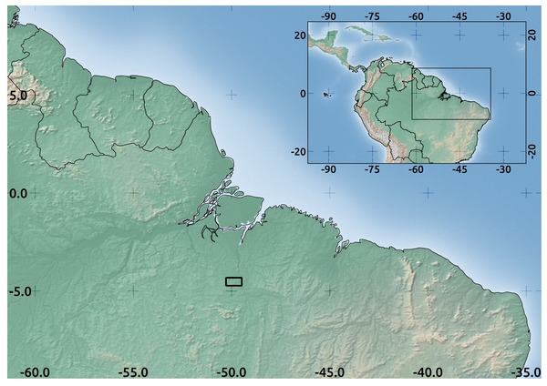
Study area in Brazil used in the book.
We provide various levels of the satellite data sets (all 7z archives, download software for free):
download all datasets (1.1 GB) – this includes:
- Landsat 2011
- original bands
- preprocessed data
- Landsat 1988
- original bands
- preprocessed data
The vector data sets:
- IUCN protected areas
- road network
- field sampling locations
- species locations
- animal movement pattern
- preprocessed files
Moreover we provide the following data sets which are used or created within the book:
- the EarthExplorer text file with a list of all available scenes
- the Digital Elevation raster files (DEM) for the study area
- the final pre-processed data sets
- data sets to test for mosaic of scenes
- data sets to test for georeferencing
- pan-chromatic Landsat data
- final products of remote sensing data analysis done in this book
additionally the following data sets could be downloaded which are also available through the commands executed in the book (the data need to be extracted into the “raster_data” folder):
- the Global Forest Cover study site file (1 GB)
- the MODIS data for the study area (only for Chapter 10) (400 MB)
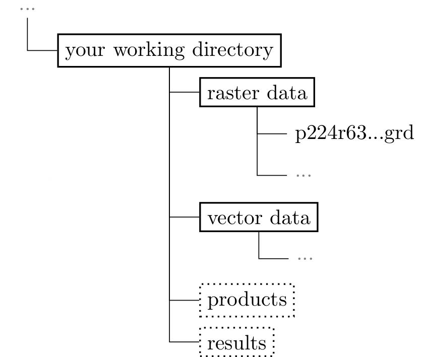 We expect a certain structure of your data if you want to follow our recipes 1:1. We used the relative path from our working directory and loading vector files by “vector_data/name_of_the_file”. Of course it is up to you to set your working directory to a different location but then all example codes have to be adapted.