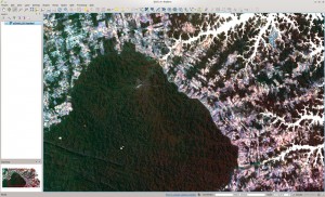
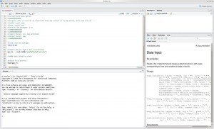
Within our book we focus on two Open Source software packages: QGIS and R. These software packages can be downloaded for free from:
R
www.r-project.org (optional IDE: www.rstudio.com)
An R cheatsheet has been created to ease the use of relevant R commands – download pdf
QGIS
www.qgis.org
Other software packaged exist which might be valuable for your research such as:
- GRASS GIS (grass.osgeo.org): The software GRASS or GRASS GIS is a hybrid combining GIS and remote sensing functionality. Its acronym stands for “Geographic Resources Analysis Support System” and is one of the biggest and most powerful raster manipulation Open-Source systems available. GRASS is based on a sophisticated data-base system, which is well adapted to multi-user environments.
- SAGA GIS (www.saga-gis.org): comprehensive stand-alone GIS with a modular plugin structure. SAGA provides a large suite of functions for terrain analysis, hydrological modelling and geostatistics. SAGA functions are accessible from QGIS.
- Orfeo Toolbox (www.orfeo-toolbox.org): remote sensing image processing software (stand-alone or API) from the French space agency (CNES). Orfeo modules are available from QGIS.
- gvSIG (www.gvsig.org): comprehensive stand-alone GIS developed for administrations. Well suited for interactive data exploration and analysis.
- uDig (udig.refractions.net): stand-alone user friendly GIS with focus on online data-sources.
- Opticks (www.opticks.org): stand-alone remote sensing image processing software for multi- and hyperspectral imagery.
- PolSARPro (earth.eo.esa.int/polsarpro): RADAR processing software from the European Space Agency (ESA)
- ….
Relevant R packages
- “raster”: the raster package provides representations for spatial raster data (see Chapter 2) with support for big rasters which exceed the size of your computer’s memory. Moreover, raster provides powerful GIS functions both for raster and vector data.
- “rgdal”: the rgdal package provides functions for import and export of spatial data in a variety of formats, e.g. Shapefiles, KML or GeoTiff and projection transformations (see Chapter 3). Rgdal interfaces the GDAL and PROJ.4 external libraries.
- “RStoolbox“: the RStoolbox packages provides functions for remote sensing data analysis. This is a very young package which is being developed in parallel with this book to facilitate the use of R in remote sensing data analysis. This package provides various common remote sensing functions such as Landsat data processing or land cover classification.
- “sp”: the sp package is automatically loaded by ‘raster’ and provides fundamental spatial object classes like SpatialPoints, SpatialPolygons or SpatialPixels, as well as projection definition and handling (see Chapter 3) and some data management and querying. The spatial classes of the sp package are intended as the underlying representation of spatial objects in R.
- “rgeos”: the rgeos package provides functions for complex GIS operations like buffering or intersecting vector data. Rgeos interfaces the external GEOS library.
Existing R scripts
As mentioned in the book several scripts are provided. Please download the scripts from our code development repository:
We highly recommend to use GIT, SVN or any other versioning system for your code developments such as github or bitbucket


