by Martin Wegmann | Jun 14, 2016 | Chapter 11, data
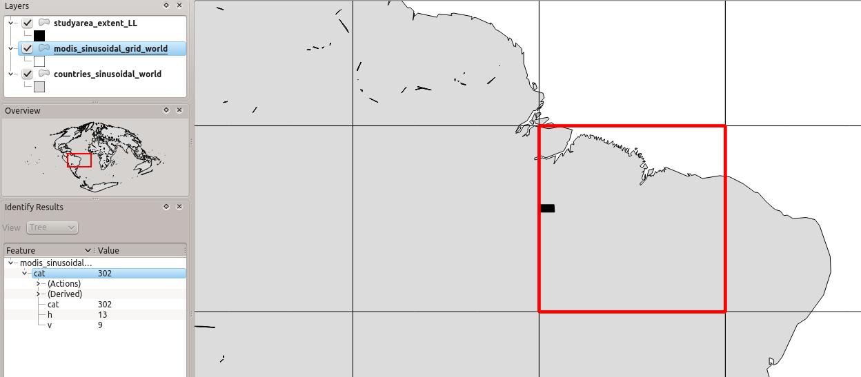
In Chapter 11 we pointed to the MODIS grid “to identify our tile, we use a shapefile with the MODIS tile system (http://gis.cri.fmach.it/modis-sinusoidal-gis-files, MODIS Sinusoidal GIS SHAPE files) and overlay it onto our study area (Figure 11.3). This shows...
by Martin Wegmann | Feb 4, 2016 | general
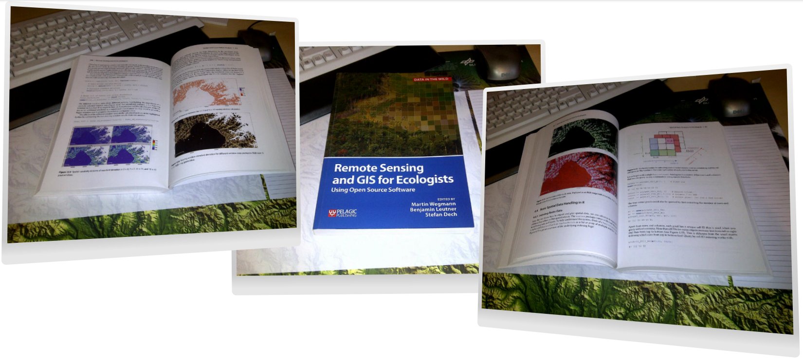
Our book “Remote Sensing and GIS for Ecologists – Using Open Source software” is now available. First copies arrived and it looks pretty good. Great to have finally a copy on our desks after all the writing, testing and editing! We hope that you enjoy it as much as we...
by Martin Wegmann | Jan 29, 2016 | general
The RStoolbox R package has been updated after some testing in courses and by colleagues. Please update your package using update.packages() or install the RStoolbox again. New functions are: new function `validateMap()` for assessing map accuracy separately from...

by Martin Wegmann | Jan 28, 2016 | general
The first copy of our book arrived today and it looks pretty good. Great to have finally a copy on our desks after all the writing, testing and editing! We hope that you enjoy it as much as we do and that it helps you to work with remote sensing and GIS in your...
by Martin Wegmann | Jan 25, 2016 | Chapter 9
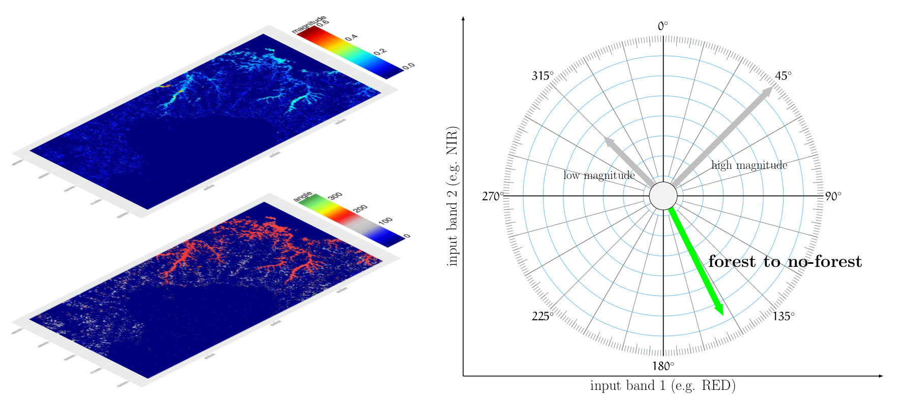
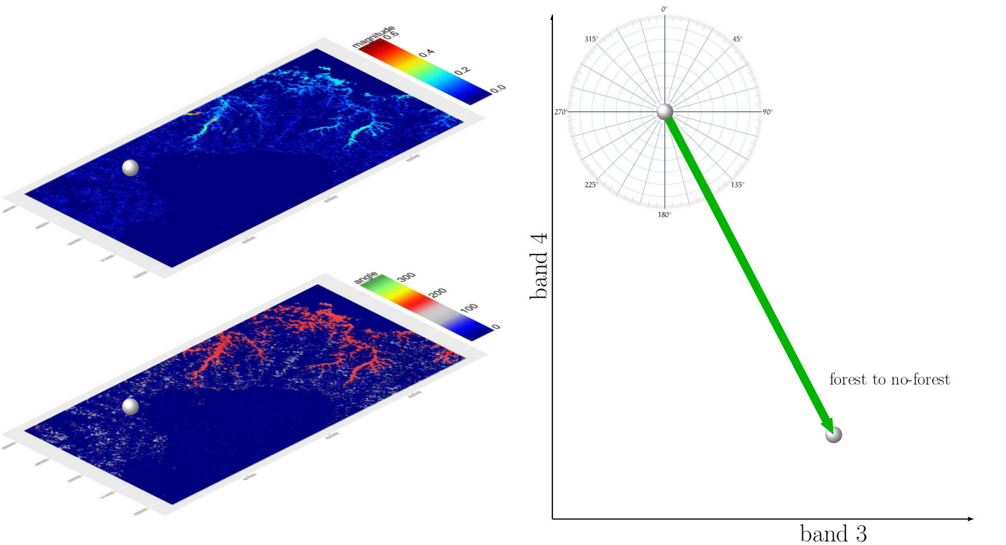
We explained in Chapter 9 among other change detection methods also the change vector analysis practically using the rasterCVA() command in the RStoolbox package, as well as outlined the approach graphically. During my last lecture on temporal and spatial remote...